High Places Web
1.
Locations
2.
freemasonry
3.
spiritism
4.
paganism
5.
Wicca
6.
The
Celts
7.
Romans
8.
Druidism
9.
Celtic
church
1) Locations
Derwydd
Derwydd is a hamlet in the south-east of Carmarthenshire, Wales, historically
situated in the parish of Llandybie, north of Ammanford.[1] It is around
halfway between Ammanford (to the south) and Llandeilo, at a rural crossroads
between the A483 and A476 roads.
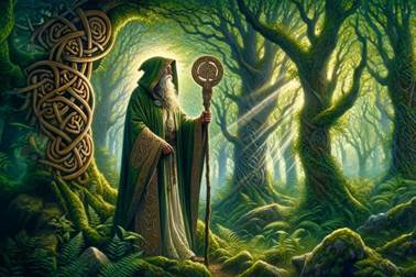
In Welsh the word for Druid is Derwydd, which is
closely related to the Welsh for oak tree - derwen.
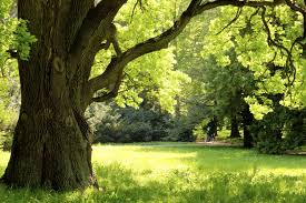
Welsh is a language directly descended from
the Brythonic language spoken by the Britons at the time of the Roman conquest.
There's an old straight track that runs from Druid's
Crag (Craig Derwydon) above the turlough down to Derwydd
behind the ancient seat of government, the Dinas (hill fort),
with its earthwork ramparts, still visible down the back road. Above there and
across, of course, is the long barrow at Castell y Graig, ring
barrows, round barrows and many ancient burials dug up and destroyed by the
quarry.
In Pantllyn quarry,
one of the most important finds in British history was made in 1813 with the
discovery of the 12 to 14 complete skeletons found in the cave and at least
5,000 years old. All this was in my book 'Warriors at the Edge of Time'.
The old straight track went down to Derwydd and on to the Druid's graves on the
mountain near the source of the loughor
and to Cwrt Bryn y Beirdd. At Derwydd mansion, although some
stones were moved and reset up in the old orchard by the antiquarian and neo Druid, Alan Stepney Gulston, other stones reputed to be
almost 20 feet high were too big to be moved when the house was built over a
thousand years ago and were incorporated into the fabric of the building.
Druids Crag
Cave
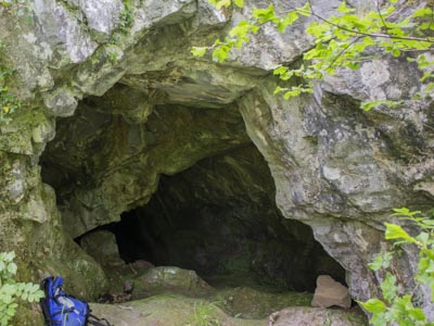
The cave is situated in an old quarry known
locally as Craig Derwyddon which is to the NW of Llandybie behind the Glan
Gwenlais quarry. From the junction opposite Glan Gwenlais quarry entrance, turn
right and follow the road for a few hundred metres, past a lake on the left. At
the far end of the lake an old quarry track leads up through the trees. At a
junction with another path turn right and enter the quarry. There were
originally two entrances to the cave but the way through the lower, larger
entrance, has now collapsed. The other entrance known as Ogof
Craig Derwyddon is situated about 5 m above the
larger and more obvious entrance.
Description An interesting cave that is formed in very
steeply angled limestone beds which are well exposed in the Glan Gwenlais
quarry immediately behind Craig Derwyddon. The entrance leads via an excavated
crawl to the large Main Chamber which has a steep floor of boulders and mud.
Some of the boulders are loose and so care must be taken.
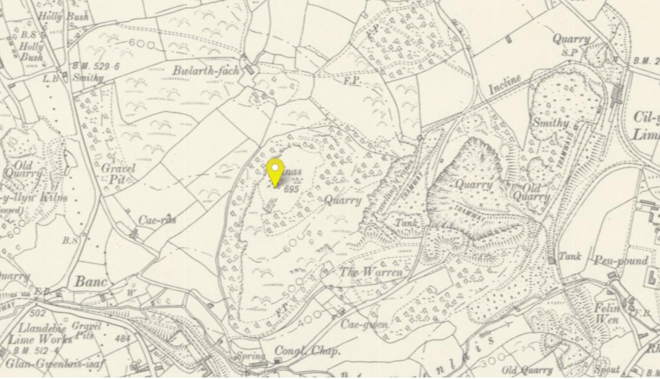
Dinas
Natural plateau on which some trenches were
dug in 1910. The digs revealed a large quantity of sheep and horse bones along
with a hyena's tooth and a well preserved human molar.
https://historicplacenames.rcahmw.gov.uk/placenames/recordedname/f2288b4a-3a07-4ff1-8305-2f71b8e8e815
Dinas - in old and middle Welsh means hill
fort.
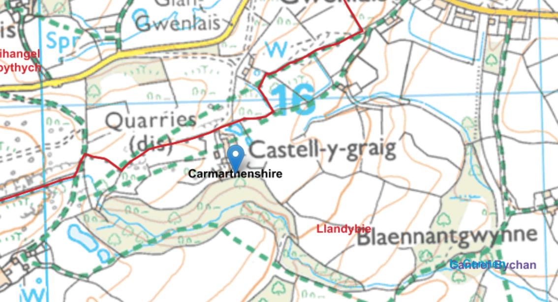
Castell y
Graig (long barrow)
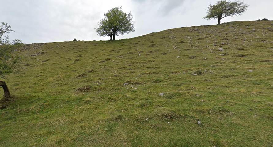
Druids
Graves (Beddau'r Derwyddon)
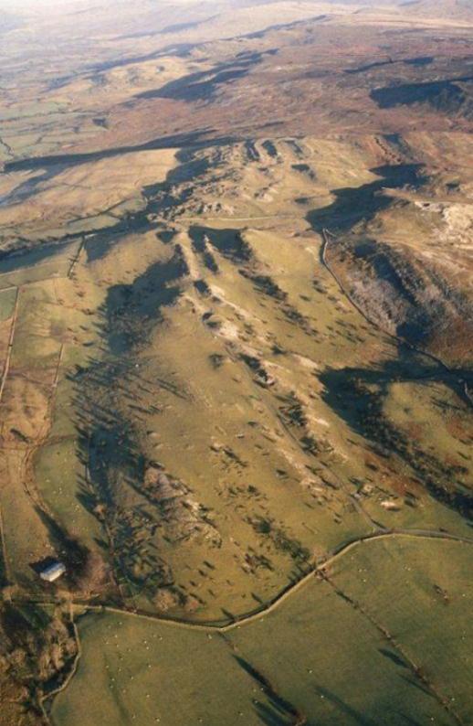
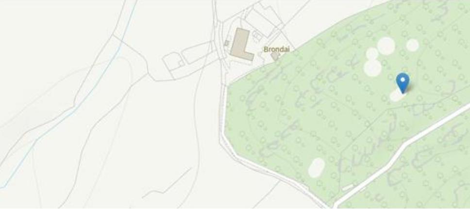
Pillow
mounts (for rabbits)?
Ffynnon
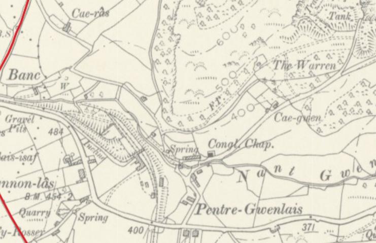
Gwenlais (PRN 790)
Ffynnon Gwenlais is a sacred Spring or
"clootie well" or pin well, near Llandybie, and is associated with
medieval Cappel Gwenlais
Site of a holy well associated with medieval Cappel
Gwenlais
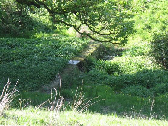
The site was seen during the Cadw Holy Wells project
of 2011. It is located within a hollow populated by dense undergrowth and
several trees. One of these trees is a tall, mature yew tree (as recorded by
Fenton in the 19th century). A spring emanates from below the western bank of a
rectilinear pond and there is a concrete-lined well, with a
modern, manhole cover, in the southwest corner. The overflow drains off to form
a stream to the east. A remnant of possible masonry to the west of the
well may be a remnant of the former chapel, although it was obscured by
heavy vegetation (M.Ings,
2011).
The Ffynnon Gwenlais is guarded by an ancient
yew tree some 1, 500 years old & considered to be protector of the Gwenlais
Valley. The double spring issuing from limestone is said to have been brought
into being by the murder of a virgin on this spot: possibly St Tybie one of the
daughters of the 5th century Welsh king Brychan Brycheiniog, who is said to
have lived there alongside her sister St Lluan. The
two sisters were devout Evangelists for the Christian faith
and it is believed they resided peacefully in what is now the town of Llandybie
until they were killed by Irish pagans. St Tybie is celebrated with a feast day
on January 30. Tybie had a cell on a meadow called Cae'r
Groes
(noted by both Edward Lhuyd in the late seventeenth century, and Richard Fenton
in 1804).
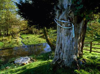
The Welsh custom of tying rags (clooties) to the branches of trees growing near
a holy well, whereby the rag is ‘offered’ to the Saint or to God as a healing ritual
also reflects their sacred qualities.
Watery places and yew trees were seen as liminal areas in our Celtic past -
places where one might make a contact with the Otherworld and its pantheon of
gods who seemed to exist in trees, rocks, springs, rivers and other natural
features of the landscape. One might intercede with the gods in one of these
liminal areas - caves, swallowholes, bogs, lakes,
rivers - were all perceived thus and there are many archaeological records of
votive deposition - anything from cauldrons, presumably once-whole chariots,
swords and slave chains
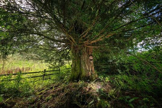
Locals consider the yew tree at Carreg Gwenlais to be the protector of the
Gwenlais Valley, Carmarthenshire.
It is situated at the head of a spring, source of the river Gwenlais and long
regarded as a holy spot – baptisms were once performed by the ancient tree.
According to legend, the spring appeared following the murder of a young virgin
girl – one theory identifies her as St Tybie, a daughter of St Brychan.
Penyrheolddu Standing
Stone (Glanamman)
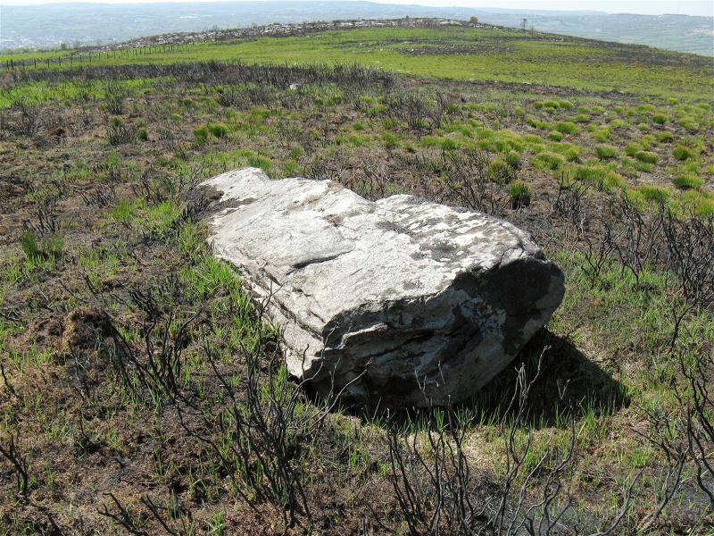
Pen-y-Coed Maen Hir (Glanamman)
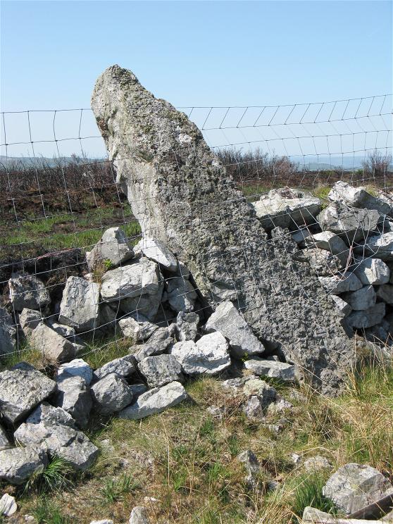
A well-known boundary stone between Llandybie and Llangadog parishes,
which may have originally been a prehistoric standing stone. The stone is
incorporated into a wall, which marks the parish boundary and is a large
upright stone, 2.6m high x 0.8m wide x 0.5m thick and tapering to a point of
0.5 x 0.2m. The stone leans 45 degrees out of vertical towards the west. A
large recumbent stone (PRN 11599) and ring cairn (PRN 13620) lie a few metres
to the west of this stone.
There is a good 360 degree view from this stone, with
the Tair Carn Isaf barrow cemetery (PRN 45568) and barrow PRN 4008 visible to
the northeast.
Penyrheolddu Ring Cairn
(Glanamman)
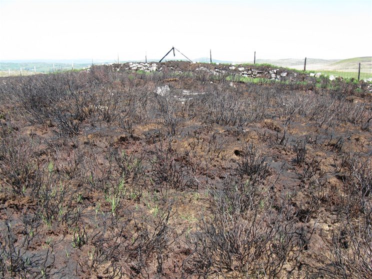
"A ring cairn lies close to a previously recorded standing stone
(SN 66011548). It consists of a slightly oval, stony ring bank with overall
measurements 13.5m (NW-SE) by 13m. The bank is of variable width and height, up
to 2m wide and 0.3m high. There is no obvious gap in the bank
but it is slightest on its south east side. The
interior is heather grown with exposed patches of limestone pavement."
Banc Crucorfod Round Cairn (Glanamman)
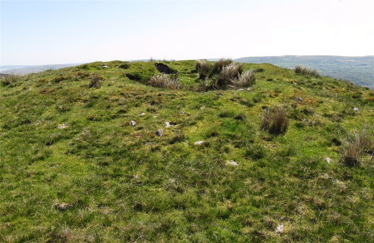
A cairn is located on a natural hillock overlooking the Aman valley at
307m above O.D. It measures 20m in diameter and 1.75m in height. The mound is
composed of mixed grade stones consolidated with grasses and heather. Towards
the N edge of the mound there lies a crater, 5m in diameter and 1m deep.
David Leighton, RCAHMW, 2001
Remains of a burial cairn, probably dating to the Bronze Age, situated
on a prominent local knoll on the open moorland of Mynydd
Isaf. Grass covered and circular on plan, measuring about 17m in diameter and
up to 1/2m in height. Much scattered stone covers the slopes of the natural
knoll upon which the cairn has been built.
Source: Cadw scheduling description.
04/10/2004/RCAHMW/FF
Tair Carn
Isaf (Glanamman)
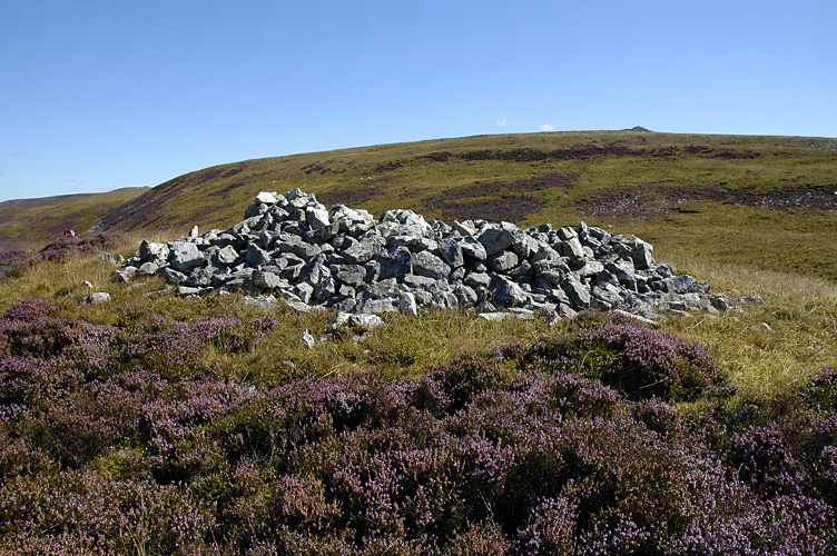
The Tair Cam Isaf cemetery occupies one of the
most prominent locations on Mynydd Du. It consists of
four large barrows (PRNs 5969, 5970, 5971, 5972), each consisting of a cairn of
loose medium-sized and large stones. Three of the cairns (PRNs 5970, 5971 and
5972) occupy the highest point on the ridge, with the fourth, PRN 5969, sited
on a local knoll, to the north of and much lower than the main ridge. There is
no doubt that the cemetery was positioned with care and deliberation, it
commands impressive and extensive distant views, which encompass the Loughor
Estuary to the southwest and the Preseli Mountains to the northwest. The
cemetery is very prominent, particularly from distance, but its summit position
and the local topography mean that the cemetery is often invisible when being
approached this is particularly the case for PRN 5969, which occupies a knoll
below the main cemetery. The revelation of the barrows at various times on the
journey to the cemetery and their final disclosure on reaching the summit was
probably an important part of the visit event and designed to enhance the whole
experience. A second barrow cemetery, Tair Cam Uchaf
(PRN 44144) lies on another local summit 1.3km to the northeast across a narrow
saddle and several other barrows are visible on other high points on Mynydd Du (Black Mountain). The size of the
barrows in both cemeteries, their location and the number of barrows in this
part of Mynydd Du emphasise the special
nature of this area. A significant feature of this area and a
characteristic of a limestone landscape is the large numbers of shake holes,
some very large, that are common across Mynydd Du.
There are a number of shake holes below the ridge
occupied by both the Tair Cam cemeteries, which may
have played a part in choosing their locations.
1 There are commanding long views from the
cemetery, with vistas southwest towards the Loughor Estuary and northwest to
the Preseli Mountains. The Tair Cam Isaf barrow cemetery (PRN 35568) is clearly
visible 1.3km to the southwest and several other large barrows are visible to
the east and southeast.
Several sink holes lie at the base of the ridge.
Tair Carn Uchaf
(Glanamman)
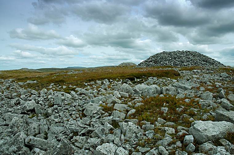
The Tair Cam Uchaf
cemetery occupies one of the most prominent locations on Mynydd
Du (Black Mountain). It consists of three impressively large barrows,
each consisting of a cairn of loose medium-sized and large stones. Two of the
barrows, PRNs 4014 and 4015 occupy the highest point of the summit, whilst PRN
4013 lies a short distance to the northwest on a separate and slightly lower
knoll. There is no doubt that the cemetery was positioned with care and
deliberation, it commands impressive and extensive distant views, which
encompass the Loughor Estuary to the southwest and the Preseli Mountains to the
northwest. The cemetery is very prominent, particularly from distance, but its
summit position and the local topography mean that the cemetery is often
invisible when being approached. The revelation of the barrows at various times
on the journey and their final disclosure on reaching the summit was probably
an important part of the visit event and designed to enhance the whole
experience. A second barrow cemetery, Tair Cam Isaf (PRN 45568) lies on another
local summit 1.3km to the southwest across a narrow saddle and several other
barrows are visible on other high points on Mynydd
Du. The size of the barrows, their location and the number of barrows in this
part of Mynydd Du emphasise the special nature of
this area. A significant feature of this area and a characteristic of a
limestone landscape is the large numbers of shake holes, some very large, that
are common across Mynydd Du. There are a number of shake holes below the ridge occupied by the Tair
Cam Uchaf cemetery, which may have been a factor in
its location.
There are commanding long views from the cemetery, with vistas southwest
towards the Loughor Estuary and northwest to the Preseli Mountains. The Tair
Cam Isaf barrow cemetery (PRN 35568) is clearly visible 1.3km to the southwest
and several other large barrows are visible to the east and southeast.
Deg Arbedd (Brynamman)
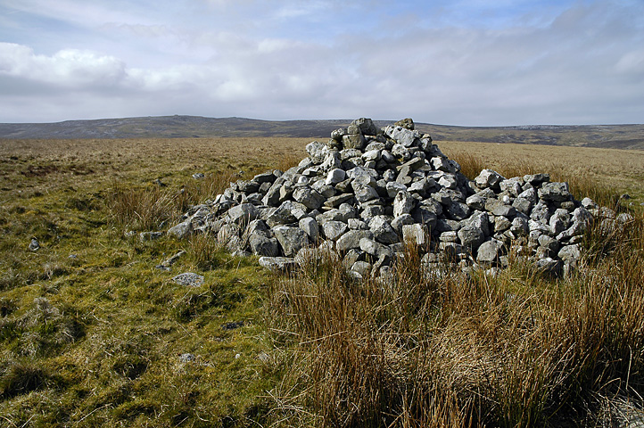
As a rough
translation the name means Ten Graves and ten cairns are visible on the skyline
from here.
RCAHMW nprn is 84094.
Garreg Fraith (Brynamman)
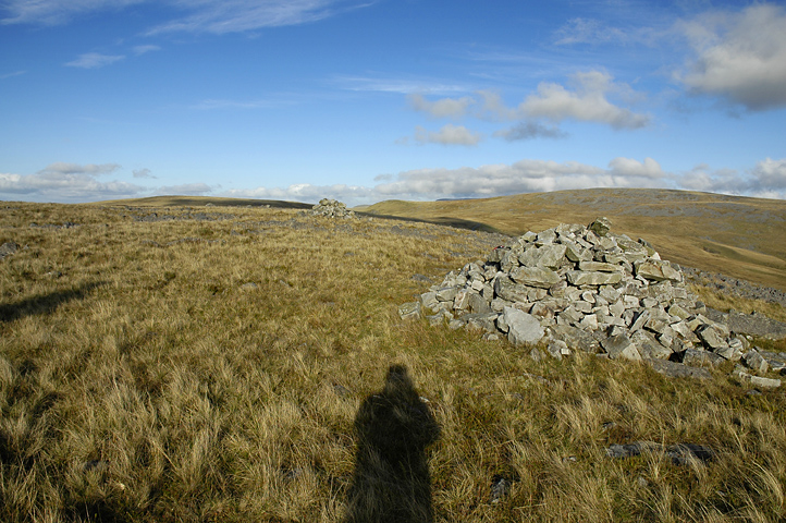
Nant-y-Llyn
standing stone done
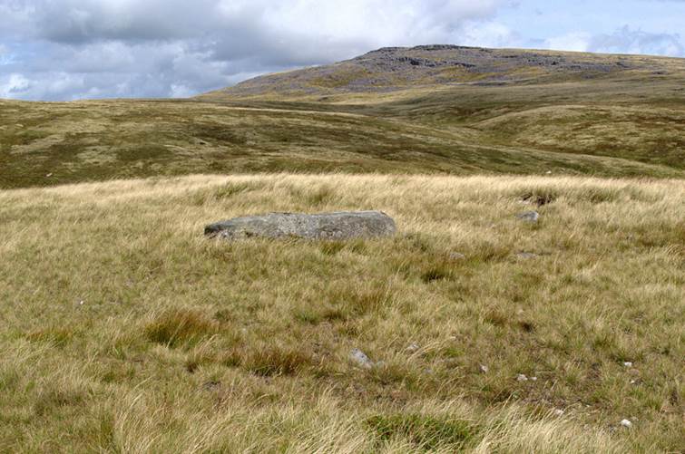
Carn Pen-y-Clogau (Brynamman)
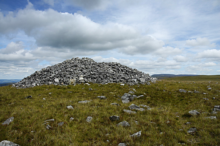
Carn Pen
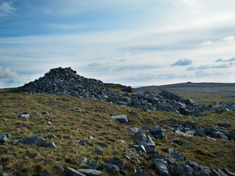
Rhiw Ddu (Brynamman)
Llandyfan Pool (Llandyfan)
Llandyfan Pool, located in Llandyfan, is traditionally
associated with the goddess Brigid. The pool and its surroundings have been
places of pilgrimage and local folklore, particularly concerning healing. In
the context of Brigid, Llandyfan Pool is considered a
sacred site where the goddess or saint was believed to have healing powers.
Pilgrims and visitors have historically visited this site to seek cures or
blessings, reflecting Brigid's enduring legacy as a deity of healing and wells
in both her pagan and Christian forms.
"Whosoever went to the spring and
drank of its waters from a human skull" (G Roberts) -
drinking from a human skull was an ancient Celtic tradition predicated on the cult
of the head.
The pool was Christianized by building a
chapel near it, the settlement (Llan) was dedicated to St Dyfan and a
baptistry was built over the pool
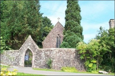
It is the big spring that spouts a stream
nearby the chapel that is the main attraction in Llandyfân,
and it was there before the chapel was built beside it. Edward Lhuyd, the
Antiquary, makes reference to it around the year 1696
'the name of a medicinal spring' in the parish of Llandybie, and he notes also
that the river Gwyddfân springs from it too. Is it
this river – guid maun ('gwydd
mawn') – noted within the bounds of Maenor Myddynfych in the Book of St Chad, recorded and written
towards the end of the eighth century? Incidentally, Llandyfân
is in the parish of Llandeilo Fawr, on the boundary
with the parish of Llandybie.
...... Richard Fenton was on tour in the area at the beginning of the
eighteenth century and he saw the spring, enclosed in a square building without
a roof, and steps leading down to it.
...... He also saw a small chapel connected to Llandeilo Fawr
whose services were held once a month. Many resorted to the spring in olden
times, he says, and many medicinal virtues were attributed to it. According to
Thomas Rees's Topographical and Historical Dictionary of South Wales (1815) the
spring had a reputation as a medicine for curing paralysis and similar
ailments. In some old maps it is ascribed 'The Welsh Bath at Llanduvaen' and that would seem to suggest that the sick
would be immersed in the water, as they did formerly in the Lake of Siloam. But
no doubt the water was also drunk." (G Roberts)
The "welsh bath" was converted into a
baptistry
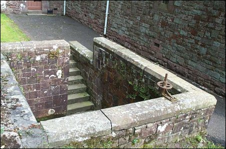
http://www.users.ic24.net/~terrynorm/llandyfan%20church.htm
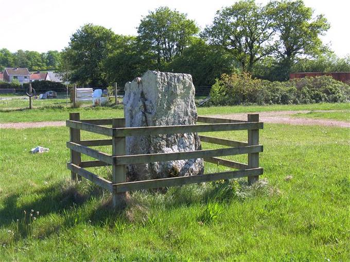
Ffairfach Standing Stone
Garn Goch
"Hill Fort"(Bethlehem)
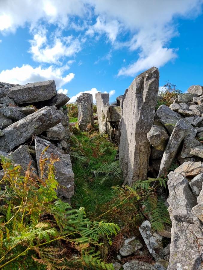
See https://llandeilo.org/garn_goch.php
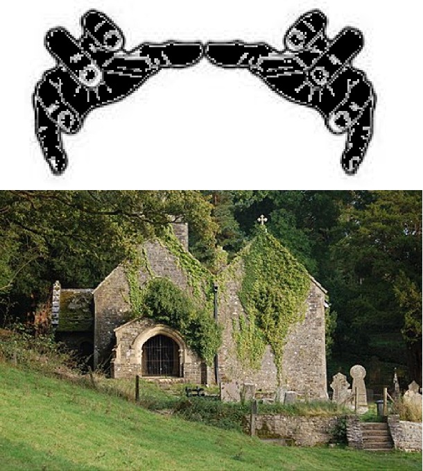
Llandyfeisant Church
(dark hand over it)
2)
Freemasonry (Carmarthen)
- Mansel Lodge No 116 (Spillman)
- Coracle Lodge 116
? (Spillman)
- De Gorllewin Installed Commanders 1535
(Spillman)
- Caerfynddin 4928 (Spilman)
- St Peters 476
Lodges
in Carmarthenshire
1.
Lodge of St Peter, No. 476
o
Location: Carmarthen
o
Established: 1841
o
Details: One of the oldest
Masonic lodges in Carmarthenshire, with a rich history and deep ties to the
local community.
2.
Lodge of Perfect Friendship,
No. 3892/8449
o
Location: Ammanford,
College Street, SA18 3AB
o
Established: 1918
o
Details: A lodge that
emphasizes fellowship and charity, actively involved in local and Masonic
charitable activities.
3.
Lliedi Lodge, No. 970
o
Location: Llanelli
o
Established: 1862
o
Details: Based in Llanelli,
this lodge has a long-standing tradition of supporting local charities and
fostering Masonic values.
4.
Tywi Lodge, No. 6892
o
Location: Llandeilo
o
Established: 1949
o
Details: Known for its
community involvement, particularly in the Llandeilo area, and for its active
role in the Provincial Grand Lodge of South Wales.
5.
The Deheubarth
Lodge, No. 9226
o
Location: Carmarthen
o
Established: 1987
o
Details: A relatively newer
lodge, named after the ancient Welsh kingdom of Deheubarth,
it continues the Masonic tradition of fraternity and charity.
6.
Cennen Lodge, No.
6977
o
Location: Llandeilo
o
Established: 1950
o
Details: A lodge that plays a
significant role in the local Masonic community, known for its charitable
efforts and Masonic education.
3. spiritism
It is useful to distinguish this from paganism. Much of what survived in Carmarthenshire existed alongside Christianity. As late as the early twentieth century, Carmarthenshire was specifically noted for the persistence of beliefs concerning fairies, goblins, fairy rings and corpse candles.
1. Tylwyth Teg — the "Fair Family"
These are probably the most important beings. The Tylwyth Teg were not simply the tiny decorative "fairies" of later children's literature. Welsh traditions portrayed them as inhabitants of an Otherworld who could interact with humans, animals and particular places.
They were especially associated with lakes, streams, caves, hills and fairy rings. Scholarly work on the tradition shows that these beliefs have a long history extending from medieval literature into nineteenth-century folklore.
This matters enormously in East Carmarthenshire because of Llyn y Fan Fach.
2. The Lady of Llyn y Fan Fach
The famous story of the Gwragedd Annwn — women of the Otherworld — associated with Llyn y Fan Fach near Myddfai is perhaps the clearest local example of what you are describing.
A supernatural woman emerges from the lake, marries a human farmer under conditions governing their relationship, eventually returns to the lake, but leaves descendants associated with the Physicians of Myddfai.
Notice the ontology implicit in the story: the lake isn't merely scenery. It constitutes a boundary between worlds and is inhabited by beings possessing intelligence, agency and their own moral rules.
That is much closer to an animistic or relational conception of landscape than modern ideas of "ghost stories".
3. Spirits associated with mountains
There is also a particularly intriguing Carmarthenshire tradition concerning a "spirit of the mist."
One account describes a white-haired old man appearing on mountain summits where the cloud touches the mountain. The same liminal boundary between mist and clear air was associated with appearances of the Tylwyth Teg.
For Mynydd Du and potentially Betws Mountain, this is particularly interesting. Mountains weren't necessarily regarded as inert topography. Certain atmospheric conditions and particular locations could be understood as places where another realm became perceptible.
4. Gwyllion — spirits of wild places
Welsh tradition also contains the gwyllion, supernatural beings associated particularly with mountains, lonely paths and wilderness.
They were said to appear to travellers and sometimes cause them to lose their way. The Welsh terminology itself has associations with ghosts, spirits and nocturnal wanderers.
Again, the interesting element is the relationship between spirit and place. You encounter the being because you've entered its landscape.
5. Corpse candles — canhwyllau cyrff
Carmarthenshire was particularly noted for belief in corpse candles.
These were mysterious lights believed to travel along the route that a funeral would subsequently take. Their appearance could therefore foretell a death.
The 1911 Encyclopaedia Britannica specifically recorded continuing Carmarthenshire belief in fairies, fairy rings, goblins and corpse candles.
That is valuable evidence because we're no longer dealing merely with medieval mythology. These were beliefs recorded among comparatively recent Carmarthenshire communities.
6. Sacred and supernatural waters
Water is especially significant.
Around East Carmarthenshire you have:
Llyn y Fan Fach → Gwragedd Annwn → Myddfai
but also springs, wells, rivers and pools associated with later Christian saints.
I suspect there is considerable unexplored material here. Christianity frequently absorbed existing relationships with particular springs and wells by associating them with saints. That does not prove that every holy well was originally pagan, but the continuity of treating individual water sources as places possessing special powers is striking.
7. Fairy rings and particular pieces of land
Another important feature of Welsh folk belief is that supernatural agency can attach to very small geographical locations.
A particular ring, mound, stone, tree or hollow might be avoided because disturbing it could have consequences.
This is particularly interesting anthropologically because it amounts to a customary restriction on human behaviour towards a place.
You don't cut that tree.
You don't disturb that mound.
You don't enter that ring at a particular time.
You don't interfere with beings inhabiting that water.
There doesn't have to be a formal priesthood or written law. The supernatural status of the place regulates human behaviour.
- Carreg Cennen Castle and cave — probably the most striking candidate for a sacred-landscape study. The natural limestone cave beneath the castle predates it and has produced evidence of earlier human activity. Later folklore includes the motif of a sleeping warrior beneath the castle.
-
Carn Goch, near Bethlehem/Llangadog — enormous prehistoric hillfort complex, incorporating earlier Bronze Age funerary activity. It is particularly interesting as a place where settlement, burial, prominent landscape and territorial identity overlap.
-
Standing Stone south of Llwyn-Du Farm, Llangadog — a substantial prehistoric monolith, about 3.3 m high. Cadw explicitly describes it as part of a prehistoric funerary and ritual landscape and notes the possibility of surviving ritual deposits.
-
Mynydd Du / the Black Mountain — not one single monument but an extensive ritual landscape. Bronze Age burial cairns occupy prominent positions across the Carmarthenshire Fans. The local authority notes that large Bronze Age burial mounds, more than 3,000 years old, remain conspicuous in this landscape.
-
Llangadog and the Sawdde valley — particularly interesting because prehistoric monuments and later Christian sacred geography coexist. Tradition attributes the establishment of a sixth-century church and monastery here to St Cadog.
-
Heol y Beddau, Llangadog — literally “Road of the Graves.” Older inhabitants associated low mounds beside this route with the burial of people who had died of plague. This is later folklore rather than evidence of paganism, but the persistence of a named landscape of the dead is fascinating.
-
Dinefwr prehistoric hillfort — an Iron Age fortified settlement existed within what is now Dinefwr Park before the Roman and medieval centres developed.
-
Llandeilo / St Teilo landscape — important for investigating the Christianisation of sacred landscapes. Llandeilo developed around an early monastery traditionally founded by Teilo and became one of the major early ecclesiastical centres of Wales.
-
River Tywi — worth treating as a cultural landscape in its own right. Rather than claiming evidence of a particular river deity, I would investigate folklore concerning the river, springs, pools, crossings and supernatural beings associated with water.
-
River Cennen — particularly interesting because of its relationship with Carreg Cennen, its limestone landscape, caves and springs.
-
River Loughor / Afon Llwchwr headwaters — another potentially important element for your purposes. The Loughor and Cennen both originate in the landscape around Carreg Cennen but take quite different routes towards the sea.
-
Llyn y Fan Fach — one of the strongest folkloric sites in the wider eastern Carmarthenshire landscape. It is associated with the Lady of the Lake and the Physicians of Myddfai. I would place this very high on our list because it combines water, supernatural agency, animals, healing knowledge and relationships between humans and an Otherworld.
-
Myddfai — inseparable from the Llyn y Fan Fach tradition. The Physicians of Myddfai make this particularly interesting for studying relationships among landscape, plants, healing and supernatural tradition.
-
The Carmarthenshire Fans — the uplands surrounding Llyn y Fan Fach contain numerous prehistoric cairns and other archaeological remains. The distribution of monuments in relation to ridges, water and visibility would be worth mapping rather than examining them individually.
-
Ancient woodland around Carreg Cennen and Trap — potentially important for an animistic interpretation. The limestone/sandstone boundary creates a striking mosaic of ash and oak woodland, wet heath, springs and species-rich grasslands.
-
Llandybie — worth investigating specifically for holy wells, early Christian sites, place-name evidence and local supernatural folklore. The RCAHMW inventory contains a separate archaeological section for Llandybie.
-
Llandyfeisant — another potentially important early sacred site around Dinefwr. I would investigate the evidence for continuity between the prehistoric/Roman landscape and subsequent Christian use rather than assume pagan continuity.
-
Bettws and the Amman Valley — archaeologically less spectacular than Mynydd Du, but potentially more interesting for vernacular landscape belief: wells, unusual trees, boundary places, streams, fairy traditions and place-names.
-
Cwmaman / Glanamman / Garnant — this is where I would do a much deeper search. The national archaeological inventory rather surprisingly lists “Cwmamman Urban (no entries)”, which doesn't mean there was no earlier sacred landscape; it means we need to look beyond the conventional monumental archaeological record.
-
Mynydd y Betws and the uplands above the Amman Valley — potentially very important because upland commons, springs, old tracks, boundary features and place-names can preserve evidence that doesn't appear in conventional lists of monuments
There is a real contemporary Wiccan presence in Carmarthenshire, although it is difficult to document specifically for East Carmarthenshire because covens are usually private and rarely advertise their membership or ritual locations.
The strongest evidence comes from the 2021 Census. Across Carmarthenshire, 59 people specifically wrote “Wicca” as their religion, while 389 identified as Pagan, 25 as Druid, 16 as Heathen and 36 as Shamanic. There were also a small number identifying with animism and witchcraft. (Census Data) These numbers are probably conservative because solitary practitioners may simply have selected “Pagan”, “Other religion” or “No religion”.
What Wicca in East Carmarthenshire is likely to look like
It is important to distinguish Wicca from the older Welsh beliefs we've been discussing. Wicca is a modern Pagan religion, principally developing in Britain in the mid-20th century through figures such as Gerald Gardner. It isn't an unbroken continuation of the religion of pre-Christian Wales.
Nevertheless, modern Wicca has features that make East Carmarthenshire particularly congenial to it: reverence for nature, seasonal cycles, ritual landscapes, a Goddess and God in many traditions, the four elements, and celebrations of the seasonal festivals commonly called the Wheel of the Year — Samhain, Yule, Imbolc, Ostara, Beltane, Litha, Lughnasadh and Mabon.
There is direct evidence of Wiccan/Pagan observance locally. For example, an organisation at Cross Hands publicly marked Imbolc as a Wiccan and Pagan festival in 2024. (en.cymrucaretraining.com)
What I haven't found publicly documented is a named Gardnerian or Alexandrian coven based specifically in Ammanford, Llandybie, Betws, Llandeilo or Cwmaman. That doesn't mean there aren't any. Traditional Wiccan covens are deliberately discreet, and practitioners generally don't publish where rituals are held. Contemporary Welsh practitioners also report that Pagan/Wiccan moots exist around Wales but are often found through personal networks rather than public directories. (Reddit)
East Carmarthenshire is particularly interesting
The fascinating question is what happens when modern Wicca encounters the much older sacred geography we have been uncovering.
A Wiccan living around Cwmaman has an extraordinary landscape available:
Mynydd y Betws — prehistoric monuments and later Arthurian associations.
Mynydd Du — cairns, water sources and an extensive prehistoric landscape.
Carreg Cennen — cave, dramatic rock formation and evidence of ancient human activity.
Llyn y Fan Fach — probably the strongest candidate of all, with the Gwragedd Annwn, supernatural cattle and Physicians of Myddfai traditions.
Carn Goch — enormous prehistoric hillfort complex.
Dinefwr/Llandeilo — prehistoric, Roman, early Christian and medieval sacred landscapes superimposed upon one another.
Cwm Aman itself — associated in medieval Welsh literary geography with the hunt of Twrch Trwyth.
That does not mean Wiccans historically worshipped at these places. Rather, contemporary Pagan practitioners can interpret ancient and folkloric landscapes through modern Pagan spirituality.
Something rather intriguing in Glanaman
My local search also produced an unexpected result: a currently listed entity called Enchanted Moon at 1 Cwmamman Road, Glanaman, SA18 1DQ.
The business listing categorises it simply as a musician, so I would not assume from the name that it is Wiccan or Pagan. But given what we're investigating, it may be worth finding out what Enchanted Moon actually is.
More broadly, I think there's an interesting research project emerging here. We could distinguish four layers of spirituality in East Carmarthenshire:
prehistoric ritual landscape → medieval Welsh supernatural/Otherworld traditions → Christian folk spirituality → contemporary Paganism/Wicca.
The really interesting question would then be whether modern Wiccans and Pagans in East Carmarthenshire are consciously using the same mountains, stones, lakes, wells and woods that carried supernatural significance in earlier Welsh traditions. That is something we could investigate rather than assume.
Shamanism
There are two quite different things we can mean by shamanism in East Carmarthenshire, and the distinction is important. One is modern shamanic practice; the other is the possibility that older Welsh traditions contained practices that anthropologists might reasonably describe as shamanic even though Welsh people did not call them “shamanism.”
The second has suddenly become much more interesting because of a 2025 scholarly paper specifically examining shamanism in Wales. Rufus Hugh Maynard Malim, writing in The Antiquaries Journal, argues from archaeology, folklore and ethnography that there are indications of fragmented shamanic practices surviving in Wales into the nineteenth century. (Cambridge UDC)
What might "Welsh shamanism" have looked like?
It would be misleading to imagine a Siberian-style shaman transplanted to Carmarthenshire. Instead, we should look for characteristic practices: altered states or trance, communication with spirits, divination, spirit mediation, healing, journeys to an Otherworld, relationships with animal or landscape beings, and specialist individuals capable of negotiating between human and supernatural worlds.
East Carmarthenshire has several traditions that become very interesting when viewed through that lens.
Llyn y Fan Fach and Myddfai are perhaps the strongest example. The Lady of the Lake belongs to another realm, emerges from a particular natural feature, establishes rules governing interaction with humans and eventually returns to that realm. Her descendants become the Physicians of Myddfai, famous for healing and plant knowledge. I wouldn't call those physicians "shamans", but the combination of Otherworld + healing + plants + sacred landscape deserves serious comparative examination.
Annwn, the Welsh Otherworld, is also important. Medieval Welsh literature doesn't present an absolute division between the natural and supernatural worlds. Humans can enter Annwn and beings from Annwn can enter the human landscape. Animals can similarly possess supernatural significance. That permeability between worlds is characteristic of many societies conventionally described as shamanic.
Animals are particularly interesting
This brings us back to Twrch Trwyth and the Amman Valley.
Twrch Trwyth isn't an ordinary wild boar. In Culhwch ac Olwen he is an extraordinary supernatural being pursued through a landscape that medieval tradition associates with places including Mynydd Amanw and Dyffryn Amanw.
From an anthropological perspective, that is much more interesting than simply describing the story as an "Arthurian legend". It preserves a world in which animals, humans, supernatural beings and landscape participate in the same cosmological system.
That resembles the relational ontologies you've encountered elsewhere, although we should not assume direct equivalence.
Modern shamanism
There is also demonstrable contemporary shamanic practice in Carmarthenshire.
For example, Ravens Lodge Shamanism at Llansteffan explicitly offers shamanic-related practice. Elsewhere in Carmarthenshire there have been public shamanic drumming ceremonies, including one documented at a Llanelli mind-body-spirit event. (West Wales Chronicle)
A Carmarthen practitioner, Sally Partington, describes practices including shamanic soul retrieval and journeying, and workshops in Celtic Shamanism and Earth Energies. (Association) Golden Grove in Carmarthenshire has also hosted contemporary events incorporating shamanic sound healing. (Ty Enfys Shamanic Activations)
Closer to eastern Carmarthenshire, Swan Healing Therapies and retreat is at Llanwrda, although its business listing describes it primarily as Reiki rather than specifically shamanic. So I would not categorise it as shamanism without stronger evidence.
The really interesting historical question
I think we should now modify the search we've been doing through the old Welsh-language sources.
Instead of searching merely for "paganism" or "spirits", we should look for descriptions of behaviour which could represent shamanic practice:
trance or possession; spirit journeys; prophetic dreams; people who spoke with spirits; healers receiving knowledge from supernatural beings; magical relationships with animals; diviners; cunning people; charmers; individuals entering fairy/Otherworld places and returning; sacred wells used for divination; and specialists who mediated between spirits and their communities.
That search could be particularly productive around Myddfai–Llyn y Fan Fach, Llangadog–Gwynfe, Carreg Cennen, Llandeilo, Llandybie, Betws and Cwm Aman.
And there is one Welsh concept I would put very high on our list: the awenydd — an inspired or ecstatic person associated with awen. Medieval descriptions of inspired Welsh practitioners have sometimes been interpreted in terms of trance or spirit possession.
Given your work on indigenous spiritual governance, a careful comparison between awenyddion and Welsh spirit mediators and the specialists you encountered in Himalayan societies could become quite substantial — provided we keep the historical evidence separate from modern "Celtic shamanism."
6) The
Celts (600 BCE - 50 AD)
·
·
The regions
of Wales were developing along tribal lines by the time the advent of iron
ushered in a new cultural change. The Ordovices in
the northeast and the Silures in the southeast are but two of these early
tribes, the names of which are not their own but those given them by late Roman
invaders.
·
The
earliest iron artefact in Wales is a sword dating to about 600 BCE, but by 400
BCE iron was being smelted and crafted into tools all over the British Isles.
·
The tribes
of Wales developed regional styles of working iron, gold, and other metals,
following the exquisite western European style known as La Tene (after the
village of La Tene in Switzerland). At the same time as iron was introduced to
Britain, a new crop of settlers arrived from northern Europe.
·
These were
the Celts, whose cultural influence cannot be overstated. Traditional history
has viewed the Celts as fierce conquerors who swept away the vestiges of
earlier cultures and took complete control of Welsh society.
·
A more
balanced and likely theory is that the actual number of Celtic newcomers was
low, and though they managed to dominate the culture of the earlier inhabitants
of Wales, they did so without changing the overall physical or racial
characteristics. So the Welsh of today are more likely
to owe their physiognomy, if not their culture, to the Beaker People rather
than the later Celts.
·
Who were the Celts?
The Iron Age is the age of the Celt in Britain. Over the 500 or so years
leading up to the first Roman invasion, a Celtic culture established itself
throughout the British Isles. Who were these Celts? The Celts as we know them
today exist largely in the magnificence of their art and the words of the
Romans who fought them.
·
The trouble
with the reports of the Romans is that they were a mix of reportage and
political propaganda. It was politically expedient for the Celtic peoples to be
coloured as barbarians and the Romans as a great civilizing force. And history
written by the winners is always suspect.
·
Where did
they come from? What we do know is that the people we call Celts gradually
infiltrated England and Wales over the course of the centuries between about
500 and 100 B.C. There was probably never an organized Celtic invasion; for one
thing the Celts were so fragmented and given to fighting among themselves that
the idea of a concerted invasion would have been ludicrous.
·
The Celts
were a group of peoples loosely tied by similar language, religion, and
cultural expression. They were not centrally governed, and quite as happy to
fight each other as any non-Celt. They were warriors, living for the glories of
battle and plunder. They were also the people who brought iron working to
Britain.
·
Celtic family life
The basic unit of Celtic life was the clan, a sort of extended family. The term
"family" is a bit misleading, for by all accounts the Celts practiced
a peculiar form of child-rearing; they didn't rear them, they farmed them out.
Children were actually raised by foster parents. The
foster father was often the brother of the birth-mother.
Clans were bound together very loosely with other clans into tribes, each of
which had its own social structure and customs, and possibly its own local
gods.
·
Housing
The Celts lived in huts of arched timber with walls of wicker and roofs of
thatch. The huts were generally gathered in loose hamlets. In several places,
each tribe had its own coinage system.
·
Farming
The Celts were farmers when they weren't fighting. One of the interesting
innovations that they brought to Britain was the iron plough. Earlier ploughs
had been awkward affairs, basically a stick with a pointed end harnessed behind
two oxen. They were suitable only for ploughing the light upland soils.
·
The heavier
iron ploughs constituted an agricultural revolution all by themselves, for they
made it possible for the first time to cultivate the rich valley and lowland
soils. They came with a price, though. It generally required a team of eight
oxen to pull the plough, so to avoid the difficulty of turning that large a
team, Celtic fields tended to be long and narrow, a pattern that can still be
seen in some parts of the country today.
·
The lot of women
Celtic lands were owned communally, and wealth seems to have been based largely
on the size of cattle herd owned. The lot of women was
a good deal better than in most societies of that time. They were technically
equal to men, owned property, and could choose their own husbands. They could
also be war leaders, as Boudicca (Boadicea) later proved.
·
Language
There was a written Celtic language, but it developed well into Christian
times, so for much of Celtic history they relied on oral transmission of
culture, primarily through the efforts of bards and poets. These arts were
tremendously important to the Celts, and much of what we know of their
traditions comes to us today through the old tales and poems that were handed
down for generations before eventually being written down.
·
Druids (See
below)
·
Religion
From what we know of the Celts from Roman commentators, who are, remember,
witnesses with an axe to grind, they held many of their religious ceremonies in
woodland groves and near sacred water, such as wells and springs. The Romans
speak of human sacrifice as being a part of Celtic religion.
·
One thing
we do know, the Celts revered human heads. Celtic warriors would cut off the
heads of their enemies in battle and display them as trophies. They mounted
heads in doorposts and hung them from their belts. This might seem barbaric to
us, but to the Celt the seat of spiritual power was the head, so by taking the
head of a vanquished foe they were appropriating that power for themselves. It
was a kind of bloody religious observance.
·
The Celts at War
The Celts loved war. If one wasn't happening, they'd be sure to start one. They
were scrappers from the word go. They arrayed themselves as fiercely as
possible, sometimes charging into battle fully naked, dyed blue from head to
toe, and screaming like banshees to terrify their enemies.
·
They took
tremendous pride in their appearance in battle, if we can judge by the
elaborately embellished weapons and paraphernalia they used. Golden shields and
breastplates shared pride of place with ornamented helmets and trumpets.
·
The Celts
were great users of light chariots in warfare. From this chariot, drawn by two
horses, they would throw spears at an enemy before dismounting to have a go
with heavy slashing swords.
·
They also
had a habit of dragging families and baggage along to their battles, forming a
great milling mass of encumbrances, which sometimes cost them a victory, as
Queen Boudicca would later discover to her dismay. As mentioned, they beheaded
their opponents in battle and it was considered a sign
of prowess and social standing to have a goodly number of heads to display.
·
The main
problem with the Celts was that they couldn't stop fighting among themselves
long enough to put up a unified front. Each tribe was out for itself, and in
the long run, this cost them control of Britain.
·
If the
physical makeup of the Welsh people owes more to the Beaker People, Welsh
culture is largely a Celtic one. The warlike Celts, with their reverence for
martial heroism, left an indelible mark on the folk tales and cultural myths of
Wales, myths which grew through time into the mass of legends we know as
the Mabinogion.
·
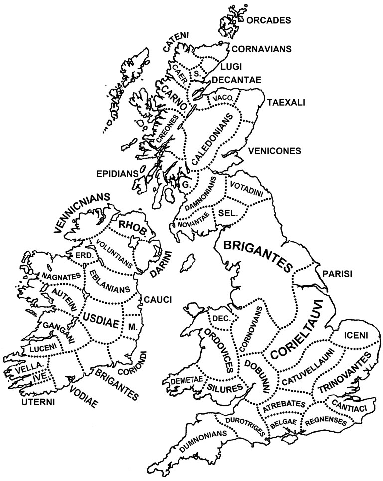
The Silures
·
a powerful people of ancient Britain,
occupying much of southeastern Wales. Incited by the king of the Trinovantes tribe, Caratacus, they fiercely resisted the
Roman conquest from about AD 48. A Roman legionary fortress was established
first at Glevum (Gloucester) and later at Isca (Caerleon), and by 78 the Silures were overcome by
Sextus Julius Frontinus (73/74–77). Their capital had been a hill fort, Llanmelin, but the Romans forcibly transferred the
inhabitants about 1 mile (1.6 km) south to a new town, built in the rectangular
Roman pattern. This new town under the Romans was Venta Silurum
(Caerwent, southwest of Chepstow, Monmouthshire). Its
massive Roman walls survive, and excavations have revealed a basilica, baths,
and an amphitheatre; there is little sign of Romanization outside Caerwent
7) The
Romans
Dynevor
Park
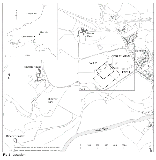
The Romans
built two forts in Llandeilo, Carmarthenshire, after invading Britain in 43 AD:
First fort:
Built around AD 70, this fort may have been one of the largest Roman campaign
forts in Wales, covering 3.9 hectares. It may have housed a Roman legionary
detachment.
Second
fort: Built around AD 80.
Llandeilo
Roman Fort, Carmarthenshire – Heneb – The Trust ...
The Roman
army abandoned the forts around AD 120. In 2003, a geophysical survey team
discovered the forts in Dinefwr Park on the outskirts of Llandeilo, and
excavations in 2004 confirmed the findings. The discovery also revealed a
civilian settlement, a Roman road, and a possible Roman bathhouse site.
Some say
that the establishment of Llandeilo as a Roman military center
may have led to the development of an early Christian community, which could
have eventually led to the formation of Llandeilo Fawr.
An idea of
what the fort might have looked like can be seen in the geophysical survey and
an artist's impression below.
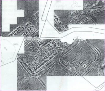
2003
Geophysics of Llandeilo's Roman Fort. The curved and other lines are the
various perimeter ditches and wall bases just under the field's surface. The
shadow of the two forts can be seen in the lower part of the image produced by
the geophysical survey. The settlement outside the gates can also be seen in
the upper right-hand quarter of the image. The white areas in the image are
parts the surveyors couldn't access. (Geophysics map from the Cambria
Archaeology newsletter, No 2, Summer 2003.)
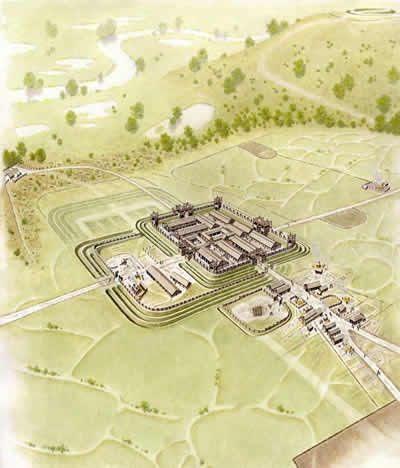
Painting by
Neil Ludlow of what the second fort may have looked like around 100AD (Drawing:
Cambria Archaeology)
https://www.dyfedarchaeology.org.uk/wp/wp-content/uploads/llandeiloromanforts2003-2007.pdf
.
9) Celtic
Christianity in Wales
The Celtic Church in Wales,
along with other Celtic regions like Ireland and Scotland, maintained a degree
of independence from the Roman Church until the Synod of Whitby in 664 AD.
However, it's important to note that the Synod of Whitby primarily affected the
Anglo-Saxon Church in Northumbria, rather than directly changing the practices
of the Welsh Church at that time. The Celtic Church in Wales continued to
preserve its distinct practices for some time even after Whitby
.The Celtic Christianization of the Brecon Beacons was
a key part of the broader Christianization of Wales. Through the efforts of
saints like St. Gastyn, St. Cadoc, and St. Illtud, Christianity took root
in this remote and rugged region. The support of local rulers like King Brychan and the establishment of
monastic communities helped to solidify the Christian faith in the area,
blending it with existing Celtic traditions and leaving a
lasting legacy that continues to influence the spiritual landscape of
the Brecon Beacons today.
The King of Brecon in Celtic
times, known as Brychan, had his court at Talgarth.
He was a Godly Christian man, albeit a warrior King and he was trained from the
age of 5 in spiritual matters. Born of Irish parents, he lived his life
in Wales. He had 3 marriages and copious children, nobody is quite sure
how many but all of them were trained in
the Christian Celtic church by a spiritual mentor, Saint Gastyn. Brychan himself was recognised as a Celtic saint
and at the end of his life retired to live as a hermit.
Saint Gastyn, who mentored all Brychan’s children in
the ways of God.
Set at the base of the Black Mountains in Wales, and
alongside Llangorse Lake, the church at Llangasty is built on an ancient Celtic Christian site
where a Celtic monk, Gastyn lived. King Brychan sent all his children to be discipled
by this monk before they went out as missionaries across Wales, Cornwall and
Brittany. The modern church is still called St Gastyn’s. Llan in a place name
denotes that there was a Celtic Christian prayer oratory or monk’s cell in that
spot, so Llangasty refers to the place of Gastyn.
St. Gastyn is traditionally
considered to have been a tutor or spiritual advisor to King Brychan. According
to some versions of the legend, Brychan placed great trust in Gastyn, who was
possibly responsible for the early Christian education of Brychan and his
children. This relationship between Gastyn and Brychan further solidifies the
saint's role in the Christianization of the region.
|
 Brychan Brycheiniog, Brychan Brycheiniog,
King of Brycheiniog
(Born c.AD 419)
(Latin: Brocanus; English: Brecon)
St.
Brychan Brycheiniog was the son of King Anlach of Garthmadrun by Marchel, heiress of that kingdom. Perhaps
he was a freckled baby as his name implies. Brychan was born in Ireland but,
soon afterward, his parents moved Wales, to Y Fenni-Fach, then Marchel's
homeland of Garthmadrun. At the age of four,
Brychan was sent to be tutored by a holy-man named Drichan
beside the River Ysgir. Seven years, Brychan was
schooled in the ways of the World, before the poor blind Drichan
finally called Brychan to bring him his trusty spear for the last time. With
it, he pointed to a nearby boar and a stag who came from the forest to stand
with a fish in the river, by a beech-tree dripping with honey; and Drichan predicted a happy and abundant future for the
young Brychan.
A few
years later, war broke out between Anlach and Banadl, the usurping Irish King of Powys. The fight did
not go well for Anlach, and he was forced to send
Brychan to Powys as a hostage in order to protect
his lands. Brychan was treated well at the Irishman's court, but he fell
madly in love with his host's daughter, Banhadlwedd. The match was frowned
upon and, overcome with lust, Brychan took the poor
girl by force. Before Brychan was sent back to Gathmadrun
at the end of the War, the Irish Princess bore him a son named Cynog. Brychan gave his child a
golden armilla as a sign of his paternal recognition.
Back in Garthmadrun, Anlach eventually
died and the nobles raised Brychan to the Kingship. From Talgarth,
His reign was triumphant, as Drichan had predicted,
and the people decided to rename the Kingdom Brycheiniog in his honour. He
was a saintly King dedicated to the Christian Church and its teachings. He
married three times and had so many saintly children, they are almost impossible
to count. The most popular figure is twenty-four sons and twenty-four
daughters. Together they are known as one of the "Holy Families of
Britain".
Depsite his piety, Brychan was not above defending his
lands or his family when the need arose. One of his eldest daughters, Gwladys, was once abducted by King Gwynllyw of Gwynllwg.
Brychan and his armies pursued them for many days and many nights before a
horrendous battle was fought at which many men fell. Luckily, the High-King Arthur intervened and the two
Welsh Monarchs were soon reconciled. On another occasion, the King of Dyfed
(or Gwynedd) raided Brychan's Kingdom in order to
dispel a boast by one of his countrymen, that no spoil could ever be taken
from Brychan's land. When the King of Brycheiniog discovered this treachery,
he led his armies to a great battle victory, after which the dismembered
limbs of the enemy were collected as trophies!
In old
age he is believed to have abdicated the throne of Brycheniog
in order to become a hermit. He was succeeded in
Brycheiniog by his eldest son, Rhain Dremudd. Professor Thomas suggests
that Brychan's life at this period should be identified with that of his
so-called son, St. Nectan. He died at a great age in
the mid-5th century and was buried on Ynys Brychan (possibly Lundy Island).
Records
of St. Brychan date back to the 12th century. He is generally considered
legendary.
Other Welsh sources claim the
following additional sons:
|
Caian
|
|
Cynbryd
|
|
Cynfran
|
|
Cynin
|
|
Dogfan
|
|
Dyfnan
|
|
Dyfrig
|
|
Hychan
|
|
Llecheu
|
|
Neffei
|
|
Rhawin
|
|
Llofan
|
|
Llonio
|
|
Heilin
|
|
Afallach
|
|
Gwynnen
|
|
Gwynnws
|
The De Situ Brecheniauc also lists the following daughters:
|
Meleri
|
|
Hunydd
|
|
Gwladys
|
|
Ceingar
|
|
Tudglid
|
|
Nyfain
|
|
Gwawr
|
|
Marchell
|
|
Lluan
|
|
Gwrygon Goddeu
|
|
Arianwen
|
|
Bethan
|
|
Ceinwen
|
|
Cerddych
|
|
Clydai
|
|
Cynheiddon
|
|
Dwynwen
|
|
Eiliwedd
|
|
Goleudydd
|
|
Gwen
|
|
Lludd
|
|
Tudful
|
|
Tudwystl
|
|
Tybie
|
|
St Lluan
=======
Llanlluan
Chapel
https://coflein.gov.uk/en/site/417590/
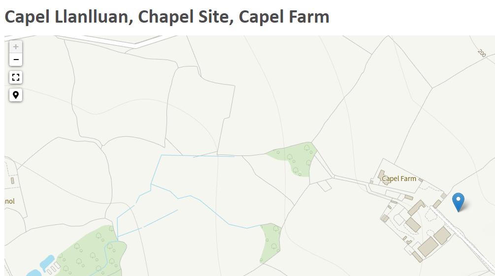
Ffynnon Lluan
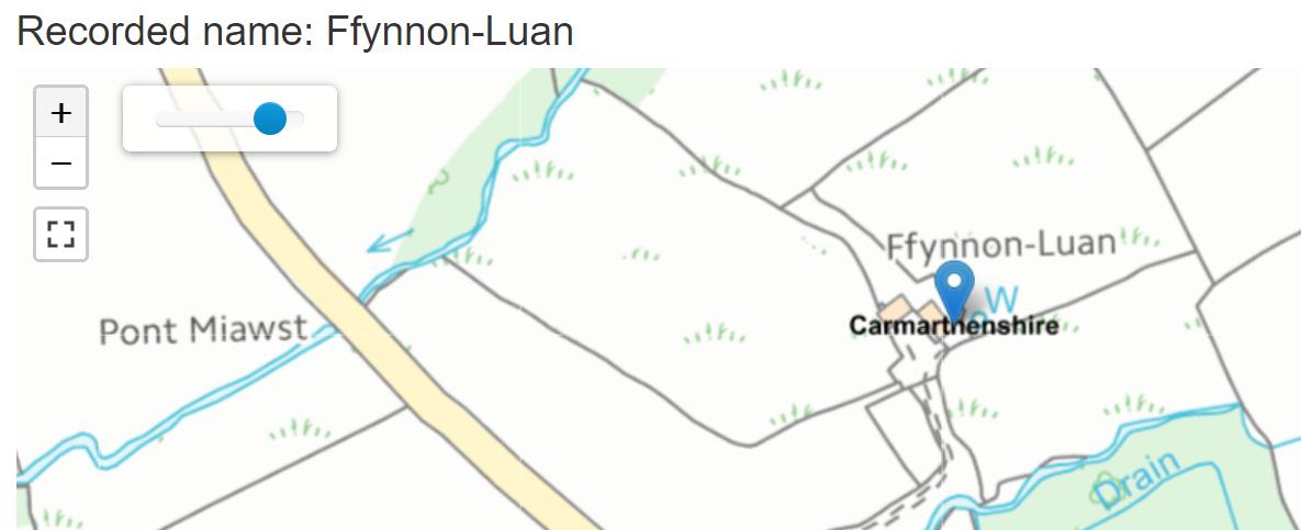
Llanlluan (Llan-Llwyn)
LLANLLUAN (LLAN-LLWYN), with Trêcastell, a hamlet, in the parish of Llanarthney,
hundred of Iscennen, union
and county of Carmarthen, South Wales, 9½ miles (E. S. E.) from Carmarthen;
containing 1053 inhabitants, of whom 677 are in Llanlluan,
and the remainder in Trêcastell. The hamlet lies near
the northern declivity of Mynydd Mawr. Llanlluan takes its name from an ancient chapel which
existed here.
St Tybie
"One of Brychan's daughters was Tybie, or Tybieu as it appears on old documents. S. Baring Gould
states that she blossomed in the fifth century, and
was killed by Irish pagans around the middle of that century. Her father
held court at Court Brycheiniog, attached to Garngoch,
a strong fortress on the edge of the Towy Valley. [The remains of Garngoch are still there today, just above Bethlehem].
Brychan was strongly opposed in his attempts to push his influence into Ystrad Towy and Glamorgan, and in a rebellion, Tybie was
killed where Llandybie church now stands. Nearby is Gelli-forynion (maidens grove), where tradition has it that
she and her sister Lluan and others lived in holy
meditation. Their well is also nearby.
...... The story in Baring Gould and Fisher's standard
book is somewhat similar; in this version, English or Irish rovers killed her.
Mention is made of two traditions regarding the place of her martyrdom. One is
where the present church stands, the other about half a mile away where a
crystal spring gushed forth. In this book the sister's name is given as Lluan, and Llanlluan nearby is
dedicated to her. Tybie had a cell on a meadow called Cae'r
Groes (a farmhouse today, above the village).
...... Mention must be made of the tradition that the old
church did not stand on the spot where the present church stands. The location
of many of the old churches in Carmarthenshire was related to the religion that
was in the country before the coming of Christianity; very often the church was
raised within a circle of stones that were regarded for some obscure reason as
sacred. In some old churches, the stones forming the circle can still be seen
in the walls of the churchyard, and it was common to have circular churchyards
– Bettws churchyard is round, and so was Llandybie before it was
extended."
Ffynnon Tybie
is a holy well named after Saint Tybie, located near
Llandybie, Carmarthenshire, Wales. The word "Ffynnon" in Welsh means
"well" or "spring," and such wells were often associated
with saints in Wales, believed to possess healing properties or spiritual
significance.
View ESE of Ffynnon Gwenlais holy well & source of
the Gwenlais river guarded by an ancient yew tree some 1, 500 years old &
considered to be protector of the Gwenlais Valley. The double spring issuing
from limestone is said to have been brought into being by the murder of a
virgin on this spot: possibly St Tybie, a daughter of St Bry
Ffynnon Tybie would have been an important site for local
pilgrims, particularly in the medieval period. People likely visited the well
seeking healing or blessings, a common practice at holy wells dedicated to
saints. The well's association with Saint Tybie connects it to the broader
tradition of veneration of early Christian saints in Wales.
Though specific details about Ffynnon Tybie's history and
any miracles attributed to it are sparse, the well would have been an integral
part of the religious life in the area. Holy wells like this one were often the
centres of local religious devotion, playing a crucial role in community
practices and beliefs.
The well, like the church dedicated to Saint Tybie in
Llandybie, helps to preserve the memory and veneration of this lesser-known
saint, reflecting the deep roots of Christian tradition in the region.
According to Francis Jones in his much-accredited book The
Holy Wells of Wales the well at Gwenlais Springs is located at Cappel
Gwenlais (PRN 790). According to the late Mair Jones Rees baptisms took place
in the next field down in Glan Gwenlais Farm.